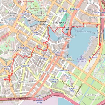
Singapore
- Distance: 7.7 Km
- Elevation gain: 121 m
- Maximum elevation: 24 m
- Elevation loss: 114 m
- Minimum elevation: 1 m
Interactive trail map
Trail profile
- Distance: 7.7 Km
- Elevation gain: 121 m
- Maximum elevation: 24 m
- Elevation loss: 114 m
- Minimum elevation: 1 m
About this trail
Name: Singapore trail, distance, elevation, map, profile, GPS track
Start: Bayfront, Sheares Avenue, Marina South, Central, Singapore, 018957, Singapore (1.28136 103.85876)
Coordinates: 1.27649 103.83932 1.28964 103.86132
Other hiking, mountain biking, running and outdoor activity trails
Click on a trail to view its statistics, map and profile.
Singapore East Coast Park
Distance: 12.6 Km • Elevation gain: 79 m • Maximum elevation: 22 m
Directions from Duck Tour Ramp to Marina Boulevard, Singapore
Distance: 105.3 Km • Elevation gain: 812 m • Maximum elevation: 51 m