McAfee Knob via Appalachian Trail on Catawba Mountain
The McAfee Knob hike is a must-do for anyone who enjoys panoramic mountain views. The trail offers a mix of shady forest paths, steady inclines, and a few rest stops along the way, making it a comfortable yet challenging route up Catawba Mountain. Once you reach the iconic rock ledge, you’re rewarded with breathtaking views of the Catawba Valley and Roanoke, an experience that feels almost otherworldly, especially at sunrise or sunset. #Hiking #Mountain #Forest #Nature
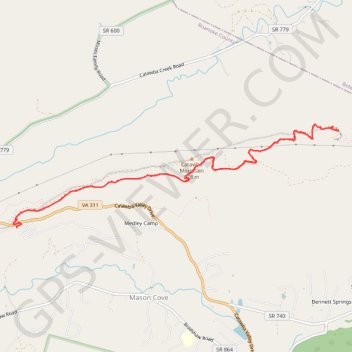
- Distance: 13.8 Km
- Elevation gain: 521 m
- Maximum elevation: 952 m
- Elevation loss: 523 m
- Minimum elevation: 579 m
- Moving time: 3 h 58 m
- Moving speed: 3.5 Km/h
- Maximum speed: 8.9 Km/h
- Total time: 4 h 52 m
- Global speed: 2.8 Km/h
Interactive trail map
Trail profile
- Distance: 13.8 Km
- Elevation gain: 521 m
- Maximum elevation: 952 m
- Elevation loss: 523 m
- Minimum elevation: 579 m
- Moving time: 3 h 58 m
- Moving speed: 3.5 Km/h
- Maximum speed: 8.9 Km/h
- Total time: 4 h 52 m
- Global speed: 2.8 Km/h
About this trail
Name: McAfee Knob via Appalachian Trail on Catawba Mountain trail, distance, elevation, map, profile, GPS track
Coordinates: 37.37990 -80.08925 37.39326 -80.03627
Other hiking, mountain biking, running and outdoor activity trails
Click on a trail to view its statistics, map and profile.