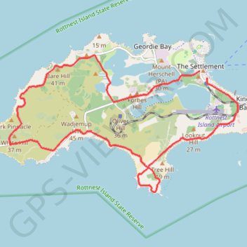
Rottnest Island Loop
Interactive trail map
Trail profile
- Distance: 19.2 Km
- Elevation gain: 169 m
- Maximum elevation: 26 m
- Elevation loss: 166 m
- Minimum elevation: 0 m
About this trail
Name: Rottnest Island Loop trail, distance, elevation, map, profile, GPS track
Coordinates: -32.02582 115.48524 -31.99253 115.55055
Other hiking, mountain biking, running and outdoor activity trails
Click on a trail to view its statistics, map and profile.
Rottnest Island Mountain Biking Loop
Australia > Western Australia > The Settlement
Distance: 39.0 Km • Elevation gain: 355 m • Maximum elevation: 27 m