Bonneville Shoreline Trail and Centenial Trail loop
- Distance: 5.0 Km
- Elevation gain: 173 m
- Maximum elevation: 1,630 m
- Elevation loss: 170 m
- Minimum elevation: 1,478 m
- Moving time: 1 h 12 m
- Moving speed: 4.2 Km/h
- Maximum speed: 15.7 Km/h
- Total time: 1 h 14 m
- Global speed: 4.1 Km/h
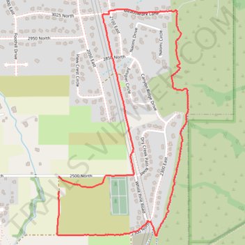
Interactive trail map
Trail profile
- Distance: 5.0 Km
- Elevation gain: 173 m
- Maximum elevation: 1,630 m
- Elevation loss: 170 m
- Minimum elevation: 1,478 m
- Moving time: 1 h 12 m
- Moving speed: 4.2 Km/h
- Maximum speed: 15.7 Km/h
- Total time: 1 h 14 m
- Global speed: 4.1 Km/h
About this trail
Name: Bonneville Shoreline Trail and Centenial Trail loop trail, distance, elevation, map, profile, GPS track
Start: 2500 North, North Logan, Cache County, Utah, 84341, United States (41.77575 -111.78598)
End: 2500 North, North Logan, Cache County, Utah, 84341, United States (41.77667 -111.78596)
Coordinates: 41.77306 -111.78612 41.78669 -111.77555
Other hiking, mountain biking, running and outdoor activity trails
Click on a trail to view its statistics, map and profile.
Uinta-Wasatch-Cache National Forest
United States > Utah > Cache County
Distance: 8.9 Km • Elevation gain: 63 m • Maximum elevation: 1,744 m