Yarra bridges
Interactive trail map
Trail profile
- Distance: 9.6 Km
- Elevation gain: 95 m
- Maximum elevation: 42 m
- Elevation loss: 92 m
- Minimum elevation: 2 m
About this trail
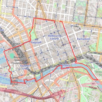
Name: Yarra bridges trail, distance, elevation, map, profile, GPS track
Coordinates: -37.82435 144.94467 -37.80594 144.97799
Other hiking, mountain biking, running and outdoor activity trails
Click on a trail to view its statistics, map and profile.
Fawkner Park and Royal Botanic Gardens loop walk
Australia > Victoria > Melbourne
Distance: 12.0 Km • Elevation gain: 137 m • Maximum elevation: 38 m
Melbourne Bike Ride
Australia > Victoria > Melbourne
Distance: 45.2 Km • Elevation gain: 272 m • Maximum elevation: 111 m