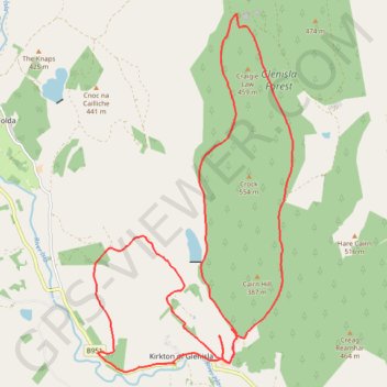
Around Kirton of Glenisla, Angus, UK
Planned eMTB Gravel: Kirkton of Glenisla - 3-hills Loop
UK, Angus, Kirkton of Glenisla
- Distance: 21.2 Km
- Elevation gain: 485 m
- Maximum elevation: 432 m
- Elevation loss: 485 m
- Minimum elevation: 239 m
- Moving time: 1 h 57 m
- Moving speed: 10.8 Km/h
- Maximum speed: 32.6 Km/h
- Total time: 2 h 31 m
- Global speed: 8.4 Km/h
Interactive trail map
Trail profile
- Distance: 21.2 Km
- Elevation gain: 485 m
- Maximum elevation: 432 m
- Elevation loss: 485 m
- Minimum elevation: 239 m
- Moving time: 1 h 57 m
- Moving speed: 10.8 Km/h
- Maximum speed: 32.6 Km/h
- Total time: 2 h 31 m
- Global speed: 8.4 Km/h
About this trail
Name: Around Kirton of Glenisla, Angus, UK trail, distance, elevation, map, profile, GPS track
Start: B951, Woodend, Kirkton of Glenisla, Angus, Scotland, PH11 8PQ, United Kingdom (56.72858 -3.28549)
End: B951, Woodend, Kirkton of Glenisla, Angus, Scotland, PH11 8PQ, United Kingdom (56.72857 -3.28544)
Coordinates: 56.72732 -3.30591 56.77709 -3.25551
Other hiking, mountain biking, running and outdoor activity trails
Click on a trail to view its statistics, map and profile.
Alyth to Spittal of Glenshee - Cateran Trail (some of)
United Kingdom > Scotland > Perth and Kinross > Alyth
Distance: 44.2 Km • Elevation gain: 1,134 m • Maximum elevation: 650 m
Spittal of Glenshee to Alyth - Some of the Cateran Trail
United Kingdom > Scotland > Perth and Kinross > Spittal of Glenshee
Distance: 38.3 Km • Elevation gain: 561 m • Maximum elevation: 459 m
EMTB Gravel: Auchintaple Loch Loop
United Kingdom > Scotland > Angus > Folda > Little Forter
Around Auchintaple Loch, nr Folda, Angus
Distance: 15.7 Km • Elevation gain: 394 m • Maximum elevation: 457 m