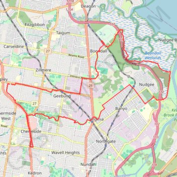
Apsley - Nudgee
Interactive trail map
Trail profile
- Distance: 31.0 Km
- Elevation gain: 163 m
- Maximum elevation: 48 m
- Elevation loss: 163 m
- Minimum elevation: 1 m
About this trail
Name: Apsley - Nudgee trail, distance, elevation, map, profile, GPS track
Start: 33, Talwin Street, Aspley, City of Brisbane, Queensland, 4034, Australia (-27.36521 153.02067)
End: 25, Talwin Street, Aspley, City of Brisbane, Queensland, 4034, Australia (-27.36531 153.02136)
Coordinates: -27.39368 153.01916 -27.34077 153.10222
Other hiking, mountain biking, running and outdoor activity trails
Click on a trail to view its statistics, map and profile.