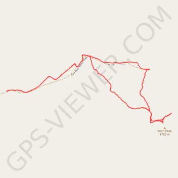
Keith Peak Loop
Loop hike to Keith Peak via East Keith Ranch Road. #Hiking #Loop #Mountain #Nature
- Distance: 7.0 Km
- Elevation gain: 463 m
- Maximum elevation: 1,723 m
- Elevation loss: 463 m
- Minimum elevation: 1,351 m
- Moving time: 2 h 27 m
- Moving speed: 2.9 Km/h
- Maximum speed: 5.0 Km/h
- Total time: 3 h 34 m
- Global speed: 2.0 Km/h
Interactive trail map
Trail profile
- Distance: 7.0 Km
- Elevation gain: 463 m
- Maximum elevation: 1,723 m
- Elevation loss: 463 m
- Minimum elevation: 1,351 m
- Moving time: 2 h 27 m
- Moving speed: 2.9 Km/h
- Maximum speed: 5.0 Km/h
- Total time: 3 h 34 m
- Global speed: 2.0 Km/h
About this trail
Name: Keith Peak Loop trail, distance, elevation, map, profile, GPS track
Start: East Keith Ranch Road, Cochise County, Arizona, United States (32.11983 -110.24476)
End: East Keith Ranch Road, Cochise County, Arizona, United States (32.11984 -110.24477)
Coordinates: 32.11590 -110.24477 32.12446 -110.22046