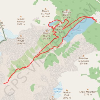
Lake Louise - Plain of 6 Glaciers - Lake Agnes
Interactive trail map
Trail profile
- Distance: 19.3 Km
- Elevation gain: 995 m
- Maximum elevation: 2,263 m
- Elevation loss: 996 m
- Minimum elevation: 1,738 m
About this trail
Name: Lake Louise - Plain of 6 Glaciers - Lake Agnes trail, distance, elevation, map, profile, GPS track
Start: Lac Louise, Improvement District No. 9, Alberta, Canada (51.41540 -116.21501)
End: Lac Louise, Improvement District No. 9, Alberta, Canada (51.41542 -116.21505)
Coordinates: 51.38631 -116.28505 51.41798 -116.21499
Other hiking, mountain biking, running and outdoor activity trails
Click on a trail to view its statistics, map and profile.
Lake Louise and Lake Agnes Loop
Canada > Alberta > Improvement District No. 9
Distance: 11.3 Km • Elevation gain: 669 m • Maximum elevation: 2,254 m