Petrified Forest Trail in Theodore Roosevelt National Park
The Petrified Forest Trail offers a fascinating journey through a striking mix of geological history and natural beauty. As you hike, you'll encounter expansive badlands, rolling prairies, and the intriguing remnants of ancient trees turned to stone. The trail provides close-up views of large petrified wood stumps, with one section offering a more compact and visually impressive display, while wildlife such as bison can often be spotted in the surrounding areas. This short but rewarding route provides a unique glimpse into the park's prehistoric past, perfect for those interested in geology and photography. #Hiking #Stone #Overlook #Nature
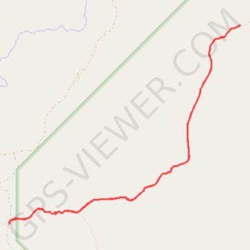
- Distance: 8.4 Km
- Elevation gain: 173 m
- Maximum elevation: 832 m
- Elevation loss: 173 m
- Minimum elevation: 777 m
- Moving time: 1 h 55 m
- Moving speed: 4.4 Km/h
- Maximum speed: 5.7 Km/h
- Total time: 2 h 12 m
- Global speed: 3.8 Km/h
Interactive trail map
Trail profile
- Distance: 8.4 Km
- Elevation gain: 173 m
- Maximum elevation: 832 m
- Elevation loss: 173 m
- Minimum elevation: 777 m
- Moving time: 1 h 55 m
- Moving speed: 4.4 Km/h
- Maximum speed: 5.7 Km/h
- Total time: 2 h 12 m
- Global speed: 3.8 Km/h
About this trail
Name: Petrified Forest Trail in Theodore Roosevelt National Park trail, distance, elevation, map, profile, GPS track
Start: Petrified Forest, 7303, Billings County, North Dakota, United States (46.99612 -103.60478)
End: Petrified Forest, 7303, Billings County, North Dakota, United States (46.99592 -103.60482)
Coordinates: 46.99592 -103.60482 47.01595 -103.57069