Thornham Walks
thornham-walks, wickham-skeith, thornham-magna
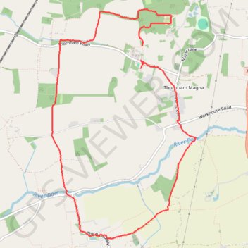
- Distance: 8.9 Km
- Elevation gain: 58 m
- Maximum elevation: 59 m
- Elevation loss: 61 m
- Minimum elevation: 38 m
- Moving time: 2 h 9 m
- Moving speed: 4.1 Km/h
- Maximum speed: 18.8 Km/h
- Total time: 3 h 46 m
- Global speed: 2.3 Km/h
Interactive trail map
Trail profile
- Distance: 8.9 Km
- Elevation gain: 58 m
- Maximum elevation: 59 m
- Elevation loss: 61 m
- Minimum elevation: 38 m
- Moving time: 2 h 9 m
- Moving speed: 4.1 Km/h
- Maximum speed: 18.8 Km/h
- Total time: 3 h 46 m
- Global speed: 2.3 Km/h
About this trail
Name: Thornham Walks trail, distance, elevation, map, profile, GPS track
Coordinates: 52.28161 1.06174 52.30685 1.08763