Self-Guided Nature Trail Loop in Konza Prairie Biological Station
The Self-Guided Nature Trail Loop offers hikers a serene experience through expansive tallgrass prairie landscapes, where one can observe diverse wildflower species, swaying grasses, and the occasional bison grazing in the distance. Interpretive signs along the trail provide insights into the local ecology, enriching the understanding of this unique environment and its significance in preserving biodiversity. The trail's gentle undulations and scenic vistas make it an accessible outing for nature lovers looking to immerse themselves in the beauty of Kansas’ natural heritage. #Hiking #Loop #Forest #Nature
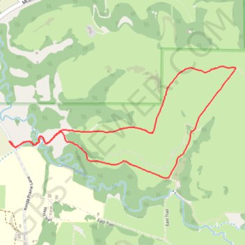
- Distance: 4.6 Km
- Elevation gain: 86 m
- Maximum elevation: 400 m
- Elevation loss: 86 m
- Minimum elevation: 326 m
- Moving time: 1 h 47 m
- Moving speed: 2.6 Km/h
- Maximum speed: 5.3 Km/h
- Total time: 1 h 58 m
- Global speed: 2.3 Km/h
Interactive trail map
Trail profile
- Distance: 4.6 Km
- Elevation gain: 86 m
- Maximum elevation: 400 m
- Elevation loss: 86 m
- Minimum elevation: 326 m
- Moving time: 1 h 47 m
- Moving speed: 2.6 Km/h
- Maximum speed: 5.3 Km/h
- Total time: 1 h 58 m
- Global speed: 2.3 Km/h
About this trail
Name: Self-Guided Nature Trail Loop in Konza Prairie Biological Station trail, distance, elevation, map, profile, GPS track
Start: Konza Prairie Lane, Riley County, Kansas, United States (39.10716 -96.60944)
End: Konza Prairie Lane, Riley County, Kansas, United States (39.10712 -96.60950)
Coordinates: 39.10471 -96.60950 39.11208 -96.59022