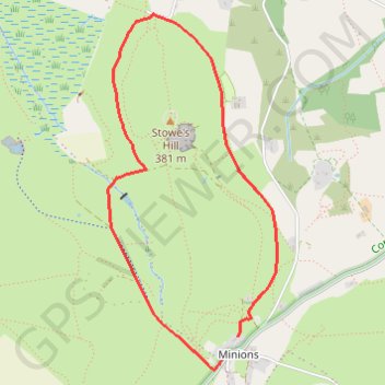
Minions - Stowe's Hill
Interactive trail map
Trail profile
- Distance: 4.7 Km
- Elevation gain: 56 m
- Maximum elevation: 330 m
- Elevation loss: 53 m
- Minimum elevation: 300 m
About this trail
Name: Minions - Stowe's Hill trail, distance, elevation, map, profile, GPS track
Start: Minions, Linkinhorne, Cornwall, England, PL14 5LR, United Kingdom (50.51392 -4.45513)
End: Minions, Linkinhorne, Cornwall, England, PL14 5LR, United Kingdom (50.51509 -4.45384)
Coordinates: 50.51339 -4.46414 50.53132 -4.45071