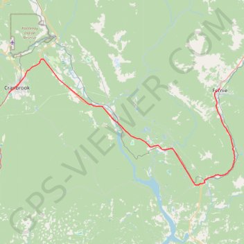
Cranbrook - Fernie
Interactive trail map
Trail profile
- Distance: 100.2 Km
- Elevation gain: 768 m
- Maximum elevation: 1,004 m
- Elevation loss: 688 m
- Minimum elevation: 746 m
About this trail
Name: Cranbrook - Fernie trail, distance, elevation, map, profile, GPS track
Coordinates: 49.29037 -115.79441 49.57481 -115.01032
Other hiking, mountain biking, running and outdoor activity trails
Click on a trail to view its statistics, map and profile.
Fairy Creek Waterfall Trail
Canada > British Columbia > Regional District of East Kootenay > Fernie
#Hiking #MTB #Snowshoeing #Forest #Falls
Distance: 4.5 Km • Elevation gain: 148 m • Maximum elevation: 1,083 m
Bike trail in Cranbrook Community Forest BC
Canada > British Columbia > Regional District of East Kootenay > Area C (Moyie/Bull River)
Distance: 12.6 Km • Elevation gain: 270 m • Maximum elevation: 981 m