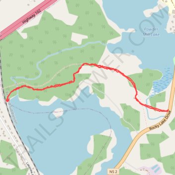
Rocky Lake Trail
- Distance: 4.1 Km
- Elevation gain: 55 m
- Maximum elevation: 55 m
- Elevation loss: 55 m
- Minimum elevation: 26 m
- Moving time: 1 h 3 m
- Moving speed: 3.9 Km/h
- Maximum speed: 8.8 Km/h
- Total time: 1 h 12 m
- Global speed: 3.4 Km/h
Interactive trail map
Trail profile
- Distance: 4.1 Km
- Elevation gain: 55 m
- Maximum elevation: 55 m
- Elevation loss: 55 m
- Minimum elevation: 26 m
- Moving time: 1 h 3 m
- Moving speed: 3.9 Km/h
- Maximum speed: 8.8 Km/h
- Total time: 1 h 12 m
- Global speed: 3.4 Km/h
About this trail
Name: Rocky Lake Trail trail, distance, elevation, map, profile, GPS track
Coordinates: 44.76737 -63.62697 44.77142 -63.60776
Other hiking, mountain biking, running and outdoor activity trails
Click on a trail to view its statistics, map and profile.
Halifax - Upper Sackville
Canada > Nova Scotia > Halifax County > Halifax
#Bike #Halifax #UpperSackville
Distance: 35.3 Km • Elevation gain: 396 m • Maximum elevation: 138 m
Brookfield - Halifax
Canada > Nova Scotia > Municipality of Colchester > Brookfield
Distance: 92.2 Km • Elevation gain: 658 m • Maximum elevation: 66 m