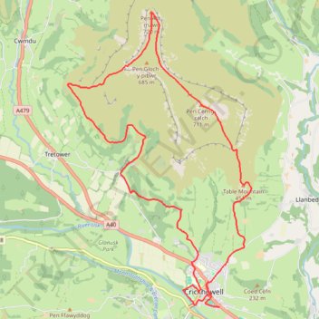
Loop hike to Pen Gloch-y-pibwr, Pen Allt-mawr, Pen Cerrig-calch and Table Mountain from Crickhowell
- Distance: 21.0 Km
- Elevation gain: 835 m
- Maximum elevation: 718 m
- Elevation loss: 843 m
- Minimum elevation: 64 m
- Moving time: 4 h 58 m
- Moving speed: 4.2 Km/h
- Maximum speed: 20.1 Km/h
- Total time: 7 h 19 m
- Global speed: 2.9 Km/h
Interactive trail map
Trail profile
- Distance: 21.0 Km
- Elevation gain: 835 m
- Maximum elevation: 718 m
- Elevation loss: 843 m
- Minimum elevation: 64 m
- Moving time: 4 h 58 m
- Moving speed: 4.2 Km/h
- Maximum speed: 20.1 Km/h
- Total time: 7 h 19 m
- Global speed: 2.9 Km/h
About this trail
Name: Loop hike to Pen Gloch-y-pibwr, Pen Allt-mawr, Pen Cerrig-calch and Table Mountain from Crickhowell trail, distance, elevation, map, profile, GPS track
End: Castle Road, Crickhowell, Powys, Wales, NP8 1AP, United Kingdom (51.85616 -3.13352)
Coordinates: 51.85616 -3.17996 51.91180 -3.12384
Other hiking, mountain biking, running and outdoor activity trails
Click on a trail to view its statistics, map and profile.
The Headstock 500
United Kingdom > Wales > Newport > Newport
Distance: 483.5 Km • Elevation gain: 9,616 m • Maximum elevation: 691 m