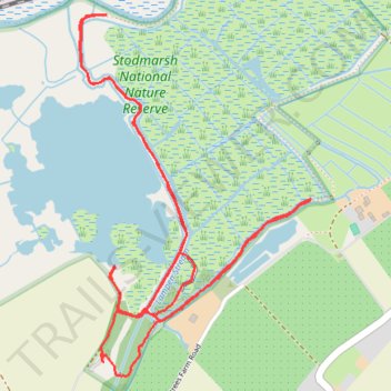
Stodmarsh National Nature Reserve
- Distance: 5.8 Km
- Elevation gain: 13 m
- Maximum elevation: 6 m
- Elevation loss: 13 m
- Minimum elevation: 1 m
- Moving time: 1 h 33 m
- Moving speed: 3.7 Km/h
- Maximum speed: 6.2 Km/h
- Total time: 2 h 35 m
- Global speed: 2.2 Km/h
Interactive trail map
Trail profile
- Distance: 5.8 Km
- Elevation gain: 13 m
- Maximum elevation: 6 m
- Elevation loss: 13 m
- Minimum elevation: 1 m
- Moving time: 1 h 33 m
- Moving speed: 3.7 Km/h
- Maximum speed: 6.2 Km/h
- Total time: 2 h 35 m
- Global speed: 2.2 Km/h
About this trail
Name: Stodmarsh National Nature Reserve trail, distance, elevation, map, profile, GPS track
Coordinates: 51.30368 1.18429 51.31447 1.19534
Other hiking, mountain biking, running and outdoor activity trails
Click on a trail to view its statistics, map and profile.
Coastal MTB loop from Canterbury in Kent Downs National Landscape
United Kingdom > England > Kent > Canterbury
Mountain biking loop from Canterbury via Folkestone, Dover, Deal and Sandwich.
Distance: 91.1 Km • Elevation gain: 834 m • Maximum elevation: 186 m