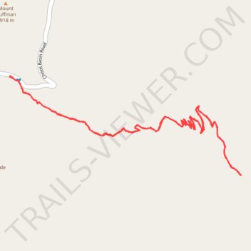
Lost Mine Trail from parking lot - Chisos Mountains
- Distance: 7.8 Km
- Elevation gain: 353 m
- Maximum elevation: 2,077 m
- Elevation loss: 352 m
- Minimum elevation: 1,756 m
- Moving time: 2 h 29 m
- Moving speed: 3.1 Km/h
- Maximum speed: 13.1 Km/h
- Total time: 2 h 59 m
- Global speed: 2.6 Km/h
Interactive trail map
Trail profile
- Distance: 7.8 Km
- Elevation gain: 353 m
- Maximum elevation: 2,077 m
- Elevation loss: 352 m
- Minimum elevation: 1,756 m
- Moving time: 2 h 29 m
- Moving speed: 3.1 Km/h
- Maximum speed: 13.1 Km/h
- Total time: 2 h 59 m
- Global speed: 2.6 Km/h
About this trail
Name: Lost Mine Trail from parking lot - Chisos Mountains trail, distance, elevation, map, profile, GPS track
Coordinates: 29.26703 -103.28652 29.27453 -103.26664
Other hiking, mountain biking, running and outdoor activity trails
Click on a trail to view its statistics, map and profile.
Lost Mine Trail in Big Bend National Park
United States > Texas > Brewster County > Chisos Mountains Basin Junction
The Lost Mine Trail offers a stunning, accessible hike that is packed with unforgettable views. The trail winds through diverse scenery, starting with a gradual ascent through forested areas before revealing breathtaking vistas over Juniper Canyon as you reach the saddle point. The final climb leads you…
Distance: 7.8 Km • Elevation gain: 367 m • Maximum elevation: 2,077 m
Lost Mountain Trail in Big Bend National Park
United States > Texas > Brewster County > Chisos Mountains Basin Junction
The Lost Mine Trail in Big Bend National Park offers an exceptional hiking experience, blending moderate challenge with spectacular rewards. As you ascend through scrubby desert landscapes and switchbacks, you'll gradually gain sweeping views of the Juniper Valley and distant peaks like Casa Grande, providing…
Distance: 7.4 Km • Elevation gain: 344 m • Maximum elevation: 2,077 m
Lost Mine Trail in Big Bend National Park
United States > Texas > Brewster County > Chisos Mountains Basin Junction
The Lost Mine Trail in Big Bend National Park offers a breathtaking journey through the Chisos Mountains, with sweeping views of Juniper Canyon, Casa Grande, and the Sierra del Carmen in Mexico. As you ascend, the trail weaves through fragrant pine and oak forests, occasionally opening to dramatic vistas of…
Distance: 7.6 Km • Elevation gain: 344 m • Maximum elevation: 2,077 m