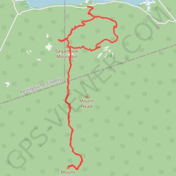
Sagamook Mountain - Mount Carleton
Interactive trail map
Trail profile
- Distance: 15.3 Km
- Elevation gain: 819 m
- Maximum elevation: 795 m
- Elevation loss: 819 m
- Minimum elevation: 283 m
About this trail
Name: Sagamook Mountain - Mount Carleton trail, distance, elevation, map, profile, GPS track
Start: Addington Parish, Restigouche County, New Brunswick, Canada (47.41827 -66.86865)
End: Addington Parish, Restigouche County, New Brunswick, Canada (47.41830 -66.86859)
Coordinates: 47.37744 -66.87939 47.41832 -66.85744
Other hiking, mountain biking, running and outdoor activity trails
Click on a trail to view its statistics, map and profile.