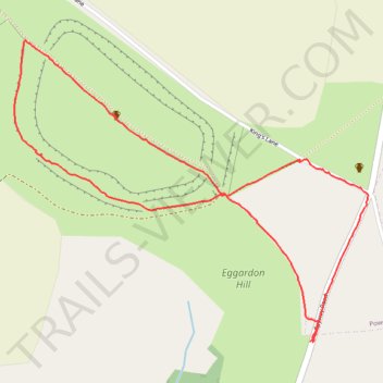
Eggardon Hill Walk
- Distance: 2.6 Km
- Elevation gain: 48 m
- Maximum elevation: 247 m
- Elevation loss: 47 m
- Minimum elevation: 223 m
- Moving time: 48 m 32 s
- Moving speed: 3.2 Km/h
- Maximum speed: 7.2 Km/h
- Total time: 1 h 10 m
- Global speed: 2.2 Km/h
Interactive trail map
Trail profile
- Distance: 2.6 Km
- Elevation gain: 48 m
- Maximum elevation: 247 m
- Elevation loss: 47 m
- Minimum elevation: 223 m
- Moving time: 48 m 32 s
- Moving speed: 3.2 Km/h
- Maximum speed: 7.2 Km/h
- Total time: 1 h 10 m
- Global speed: 2.2 Km/h
About this trail
Name: Eggardon Hill Walk trail, distance, elevation, map, profile, GPS track
Start: Spyway Road, Askerswell, Dorset, England, DT2 9EP, United Kingdom (50.74561 -2.64533)
End: Spyway Road, Askerswell, Dorset, England, DT2 9EP, United Kingdom (50.74559 -2.64526)
Coordinates: 50.74559 -2.65491 50.75178 -2.64344