Heublein Tower and King Philip's Cave via Yellow Trail in Talcott Mountain State Park
This hike offers an invigorating experience amidst stunning natural beauty. As you ascend, the trail presents scenic overlooks that reward your effort with expansive views of the Farmington Valley, particularly stunning during the fall foliage season. At the summit, the historic Heublein Tower stands proudly, providing an excellent vantage point, while nearby King Philip's Cave adds an intriguing element of exploration with its unique rock formations. #Hiking #Forest #Cave #Rock #Nature #Overlook
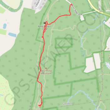
- Distance: 4.0 Km
- Elevation gain: 157 m
- Maximum elevation: 281 m
- Elevation loss: 174 m
- Minimum elevation: 157 m
- Moving time: 47 m 5 s
- Moving speed: 5.1 Km/h
- Maximum speed: 9.7 Km/h
- Total time: 51 m 45 s
- Global speed: 4.6 Km/h
Interactive trail map
Trail profile
- Distance: 4.0 Km
- Elevation gain: 157 m
- Maximum elevation: 281 m
- Elevation loss: 174 m
- Minimum elevation: 157 m
- Moving time: 47 m 5 s
- Moving speed: 5.1 Km/h
- Maximum speed: 9.7 Km/h
- Total time: 51 m 45 s
- Global speed: 4.6 Km/h
About this trail
Name: Heublein Tower and King Philip's Cave via Yellow Trail in Talcott Mountain State Park trail, distance, elevation, map, profile, GPS track
Coordinates: 41.82552 -72.79879 41.83960 -72.79226