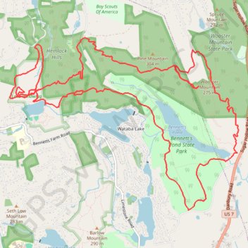
Bennett's Pond, Lake Windwing, Hemlock Hills, Pine Mountain and Wooster Mountain Loop
Morning Ride
- Distance: 19.6 Km
- Elevation gain: 452 m
- Maximum elevation: 299 m
- Elevation loss: 452 m
- Minimum elevation: 161 m
Interactive trail map
Trail profile
- Distance: 19.6 Km
- Elevation gain: 452 m
- Maximum elevation: 299 m
- Elevation loss: 452 m
- Minimum elevation: 161 m
About this trail
Name: Bennett's Pond, Lake Windwing, Hemlock Hills, Pine Mountain and Wooster Mountain Loop trail, distance, elevation, map, profile, GPS track
Coordinates: 41.32880 -73.51496 41.35348 -73.47121
Other hiking, mountain biking, running and outdoor activity trails
Click on a trail to view its statistics, map and profile.