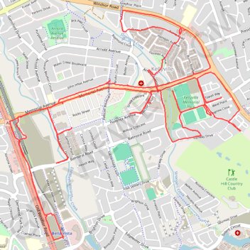
Kellyville - Memorial Ave area
- Distance: 18.6 Km
- Elevation gain: 214 m
- Maximum elevation: 95 m
- Elevation loss: 213 m
- Minimum elevation: 54 m
- Moving time: 2 h 17 s
- Moving speed: 9.3 Km/h
- Maximum speed: 26.4 Km/h
- Total time: 3 h 21 m
- Global speed: 5.5 Km/h
Interactive trail map
Trail profile
- Distance: 18.6 Km
- Elevation gain: 214 m
- Maximum elevation: 95 m
- Elevation loss: 213 m
- Minimum elevation: 54 m
- Moving time: 2 h 17 s
- Moving speed: 9.3 Km/h
- Maximum speed: 26.4 Km/h
- Total time: 3 h 21 m
- Global speed: 5.5 Km/h
About this trail
Name: Kellyville - Memorial Ave area trail, distance, elevation, map, profile, GPS track
Coordinates: -33.73150 150.93819 -33.71050 150.96362
Other hiking, mountain biking, running and outdoor activity trails
Click on a trail to view its statistics, map and profile.