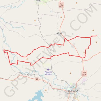
Goomburra - Mount Marshall - Pratten
Interactive trail map
Trail profile
- Distance: 89.2 Km
- Elevation gain: 749 m
- Maximum elevation: 614 m
- Elevation loss: 749 m
- Minimum elevation: 422 m
About this trail
Name: Goomburra - Mount Marshall - Pratten trail, distance, elevation, map, profile, GPS track
Coordinates: -28.13615 151.78390 -28.04262 152.11985
Other hiking, mountain biking, running and outdoor activity trails
Click on a trail to view its statistics, map and profile.
Warwick - Gatton
Australia > Queensland > Warwick
#Bike
Distance: 125.3 Km • Elevation gain: 812 m • Maximum elevation: 582 m