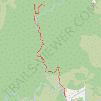
Karapoti Rata walk in Akatarawa Forest Park
- Distance: 8.9 Km
- Elevation gain: 380 m
- Maximum elevation: 387 m
- Elevation loss: 380 m
- Minimum elevation: 135 m
- Moving time: 2 h 54 m
- Moving speed: 3.1 Km/h
- Maximum speed: 8.5 Km/h
- Total time: 4 h 33 m
- Global speed: 1.9 Km/h
Interactive trail map
Trail profile
- Distance: 8.9 Km
- Elevation gain: 380 m
- Maximum elevation: 387 m
- Elevation loss: 380 m
- Minimum elevation: 135 m
- Moving time: 2 h 54 m
- Moving speed: 3.1 Km/h
- Maximum speed: 8.5 Km/h
- Total time: 4 h 33 m
- Global speed: 1.9 Km/h
About this trail
Name: Karapoti Rata walk in Akatarawa Forest Park trail, distance, elevation, map, profile, GPS track
Start: 182, Karapoti Road, Upper Hutt, Upper Hutt City, Wellington, New Zealand (-41.05964 175.09431)
End: 182, Karapoti Road, Upper Hutt, Upper Hutt City, Wellington, New Zealand (-41.05963 175.09428)
Coordinates: -41.05964 175.08467 -41.03896 175.09431