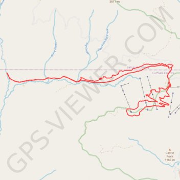
Shangri-la and Cutthroat, Hermosa Park, CO
- Distance: 32.2 Km
- Elevation gain: 719 m
- Maximum elevation: 3,252 m
- Elevation loss: 719 m
- Minimum elevation: 2,708 m
- Moving time: 2 h 39 m
- Moving speed: 12.1 Km/h
- Maximum speed: 42.5 Km/h
- Total time: 3 h 19 m
- Global speed: 9.7 Km/h
Interactive trail map
Trail profile
- Distance: 32.2 Km
- Elevation gain: 719 m
- Maximum elevation: 3,252 m
- Elevation loss: 719 m
- Minimum elevation: 2,708 m
- Moving time: 2 h 39 m
- Moving speed: 12.1 Km/h
- Maximum speed: 42.5 Km/h
- Total time: 3 h 19 m
- Global speed: 9.7 Km/h
About this trail
Name: Shangri-la and Cutthroat, Hermosa Park, CO trail, distance, elevation, map, profile, GPS track
Start: Hermosa Park Road, La Plata County, Colorado, United States (37.63608 -107.92561)
End: Hermosa Park Road, La Plata County, Colorado, United States (37.63612 -107.92558)
Coordinates: 37.61633 -107.92561 37.64040 -107.82865