Washington Park North Arboretum Ramble
- Distance: 3.6 Km
- Elevation gain: 38 m
- Maximum elevation: 29 m
- Elevation loss: 37 m
- Minimum elevation: 3 m
- Moving time: 28 m 32 s
- Moving speed: 7.6 Km/h
- Maximum speed: 13.6 Km/h
- Total time: 28 m 32 s
- Global speed: 7.6 Km/h
Interactive trail map
Trail profile
- Distance: 3.6 Km
- Elevation gain: 38 m
- Maximum elevation: 29 m
- Elevation loss: 37 m
- Minimum elevation: 3 m
- Moving time: 28 m 32 s
- Moving speed: 7.6 Km/h
- Maximum speed: 13.6 Km/h
- Total time: 28 m 32 s
- Global speed: 7.6 Km/h
About this trail
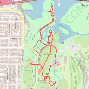
Name: Washington Park North Arboretum Ramble trail, distance, elevation, map, profile, GPS track
Coordinates: 47.63777 -122.29764 47.64466 -122.29419
Other hiking, mountain biking, running and outdoor activity trails
Click on a trail to view its statistics, map and profile.
Biking around Seattle
United States > Washington > King County > Seattle
Distance: 47.6 Km • Elevation gain: 407 m • Maximum elevation: 55 m