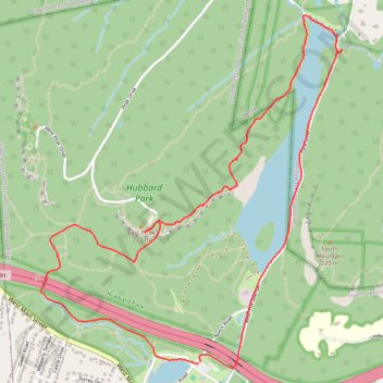
Merimere Reservoir, Castle Craig and Mirror Lake Loop in Hubbard Park
This loop is a scenic hiking route that immerses you in the natural beauty and historical significance of the area. Along the trail, hikers are treated to stunning views of the Merimere Reservoir, with its tranquil waters surrounded by lush woodlands, and the impressive Castle Craig tower, which offers panoramic vistas of the Connecticut landscape. This route not only highlights the diverse ecosystems but also invites exploration of the historical elements that enrich the hiking experience, making it an ideal outing for both nature lovers and history enthusiasts alike. #Hiking #Loop #Forest #Lake #Nature
- Distance: 7.2 Km
- Elevation gain: 246 m
- Maximum elevation: 275 m
- Elevation loss: 248 m
- Minimum elevation: 94 m
- Moving time: 1 h 49 m
- Moving speed: 3.9 Km/h
- Maximum speed: 9.4 Km/h
- Total time: 2 h 58 s
- Global speed: 3.6 Km/h
Interactive trail map
Trail profile
- Distance: 7.2 Km
- Elevation gain: 246 m
- Maximum elevation: 275 m
- Elevation loss: 248 m
- Minimum elevation: 94 m
- Moving time: 1 h 49 m
- Moving speed: 3.9 Km/h
- Maximum speed: 9.4 Km/h
- Total time: 2 h 58 s
- Global speed: 3.6 Km/h
About this trail
Name: Merimere Reservoir, Castle Craig and Mirror Lake Loop in Hubbard Park trail, distance, elevation, map, profile, GPS track
Coordinates: 41.54948 -72.84330 41.56822 -72.82197