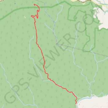
Mountains-to-Sea Trail from Widows Creek Trailhead in the Stone Mountain State Park
- Distance: 12.8 Km
- Elevation gain: 679 m
- Maximum elevation: 966 m
- Elevation loss: 680 m
- Minimum elevation: 415 m
- Moving time: 2 h 15 m
- Moving speed: 5.7 Km/h
- Maximum speed: 14.9 Km/h
- Total time: 2 h 16 m
- Global speed: 5.6 Km/h
Interactive trail map
Trail profile
- Distance: 12.8 Km
- Elevation gain: 679 m
- Maximum elevation: 966 m
- Elevation loss: 680 m
- Minimum elevation: 415 m
- Moving time: 2 h 15 m
- Moving speed: 5.7 Km/h
- Maximum speed: 14.9 Km/h
- Total time: 2 h 16 m
- Global speed: 5.6 Km/h
About this trail
Name: Mountains-to-Sea Trail from Widows Creek Trailhead in the Stone Mountain State Park trail, distance, elevation, map, profile, GPS track
Coordinates: 36.39475 -81.09025 36.43298 -81.06846