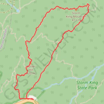
Storm King Mountain via Butter Hill Trail, Stillman Trail and Bypass Trail in Storm King State Park
The Storm King Mountain Loop is a rewarding, moderately challenging hike that brings scenic views and diverse terrain, making it popular among both locals and visitors to New York's Hudson Valley. The trail offers impressive vistas over the Hudson River, with sweeping views of the Catskill Mountains to the north on clear days. Hikers can expect a mix of steep ascents, rock scrambles, and well-marked routes like the Stillman and Butter Hill Trails, which combine to provide a dynamic experience in the heart of nature with plenty of spots to pause and appreciate the landscape. #Hiking #Loop #Mountain #Forest #River #Nature
- Distance: 3.9 Km
- Elevation gain: 170 m
- Maximum elevation: 405 m
- Elevation loss: 171 m
- Minimum elevation: 278 m
- Moving time: 1 h 17 m
- Moving speed: 3.0 Km/h
- Maximum speed: 8.7 Km/h
- Total time: 1 h 42 m
- Global speed: 2.3 Km/h
Interactive trail map
Trail profile
- Distance: 3.9 Km
- Elevation gain: 170 m
- Maximum elevation: 405 m
- Elevation loss: 171 m
- Minimum elevation: 278 m
- Moving time: 1 h 17 m
- Moving speed: 3.0 Km/h
- Maximum speed: 8.7 Km/h
- Total time: 1 h 42 m
- Global speed: 2.3 Km/h
About this trail
Name: Storm King Mountain via Butter Hill Trail, Stillman Trail and Bypass Trail in Storm King State Park trail, distance, elevation, map, profile, GPS track
End: Bypass Trail, Town of Cornwall, Orange County, New York, 12520, United States (41.42303 -74.00083)
Coordinates: 41.42299 -74.00355 41.43351 -73.99267
Other hiking, mountain biking, running and outdoor activity trails
Click on a trail to view its statistics, map and profile.
Storm King Mountain Loop via Butter Hill Trail, Stillman Trail and Bypass Trail
United States > New York > Orange County > Town of Cornwall > Village of Cornwall-on-Hudson
The Storm King Mountain Loop offers hikers a rewarding experience with its diverse terrain and panoramic vistas. The journey begins with a steep ascent up Butter Hill, leading to expansive views of the Hudson River and the surrounding mountains. As you continue along the Stillman Trail, the path meanders…
Distance: 3.8 Km • Elevation gain: 167 m • Maximum elevation: 404 m