Lake Cunningham Loop Running
Glenn Cunningham Lake Park
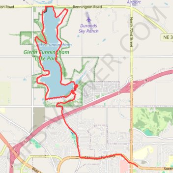
- Distance: 16.2 Km
- Elevation gain: 156 m
- Maximum elevation: 379 m
- Elevation loss: 128 m
- Minimum elevation: 331 m
- Moving time: 40 m 57 s
- Moving speed: 23.7 Km/h
- Maximum speed: 72.5 Km/h
- Total time: 54 m 4 s
- Global speed: 18.0 Km/h
Interactive trail map
Trail profile
- Distance: 16.2 Km
- Elevation gain: 156 m
- Maximum elevation: 379 m
- Elevation loss: 128 m
- Minimum elevation: 331 m
- Moving time: 40 m 57 s
- Moving speed: 23.7 Km/h
- Maximum speed: 72.5 Km/h
- Total time: 54 m 4 s
- Global speed: 18.0 Km/h
About this trail
Name: Lake Cunningham Loop Running trail, distance, elevation, map, profile, GPS track
End: 7049, Sorensen Parkway, Omaha, Douglas County, Nebraska, 68122, United States (41.31822 -96.02124)
Coordinates: 41.31822 -96.06101 41.36474 -96.02124