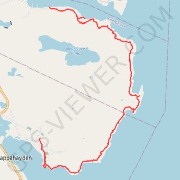
East Coast Trail - Bear Cove Point Path
#Hiking #Newfoundland #Atlantic
- Distance: 12.9 Km
- Elevation gain: 428 m
- Maximum elevation: 63 m
- Elevation loss: 405 m
- Minimum elevation: 0 m
Interactive trail map
Trail profile
- Distance: 12.9 Km
- Elevation gain: 428 m
- Maximum elevation: 63 m
- Elevation loss: 405 m
- Minimum elevation: 0 m
About this trail
Name: East Coast Trail - Bear Cove Point Path trail, distance, elevation, map, profile, GPS track
Start: Bear Cove Point Path, Fermeuse, Newfoundland, Newfoundland and Labrador, Canada (46.96499 -52.93004)
Coordinates: 46.91882 -52.93374 46.96499 -52.89292