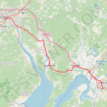
Moncton - Amherst
Interactive trail map
Trail profile
- Distance: 70.8 Km
- Elevation gain: 510 m
- Maximum elevation: 109 m
- Elevation loss: 519 m
- Minimum elevation: 5 m
About this trail
Name: Moncton - Amherst trail, distance, elevation, map, profile, GPS track
Coordinates: 45.80139 -64.78492 46.09514 -64.19895
Other hiking, mountain biking, running and outdoor activity trails
Click on a trail to view its statistics, map and profile.
Coles Island - Moncton
Canada > New Brunswick > Johnston Parish
Distance: 90.9 Km • Elevation gain: 587 m • Maximum elevation: 135 m
Amherst - Brookfield
Canada > Nova Scotia > Municipality of the County of Cumberland > Upper Nappan
Distance: 121.3 Km • Elevation gain: 1,019 m • Maximum elevation: 255 m