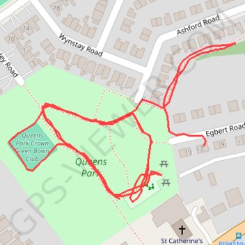
Queens Park Loop
- Distance: 1.5 Km
- Elevation gain: 7 m
- Maximum elevation: 13 m
- Elevation loss: 5 m
- Minimum elevation: 9 m
- Moving time: 23 m 11 s
- Moving speed: 4.0 Km/h
- Maximum speed: 6.3 Km/h
- Total time: 46 m 40 s
- Global speed: 2.0 Km/h
Interactive trail map
Trail profile
- Distance: 1.5 Km
- Elevation gain: 7 m
- Maximum elevation: 13 m
- Elevation loss: 5 m
- Minimum elevation: 9 m
- Moving time: 23 m 11 s
- Moving speed: 4.0 Km/h
- Maximum speed: 6.3 Km/h
- Total time: 46 m 40 s
- Global speed: 2.0 Km/h
About this trail
Name: Queens Park Loop trail, distance, elevation, map, profile, GPS track
Coordinates: 53.39910 -3.17206 53.40067 -3.16831