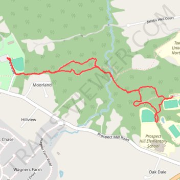
Prospect Mill Park to HCC Observatory via Walls-Cook Trail
- Distance: 4.3 Km
- Elevation gain: 64 m
- Maximum elevation: 118 m
- Elevation loss: 64 m
- Minimum elevation: 86 m
- Moving time: 1 h 11 m
- Moving speed: 3.6 Km/h
- Maximum speed: 5.9 Km/h
- Total time: 1 h 24 m
- Global speed: 3.1 Km/h
Interactive trail map
Trail profile
- Distance: 4.3 Km
- Elevation gain: 64 m
- Maximum elevation: 118 m
- Elevation loss: 64 m
- Minimum elevation: 86 m
- Moving time: 1 h 11 m
- Moving speed: 3.6 Km/h
- Maximum speed: 5.9 Km/h
- Total time: 1 h 24 m
- Global speed: 3.1 Km/h
About this trail
Name: Prospect Mill Park to HCC Observatory via Walls-Cook Trail trail, distance, elevation, map, profile, GPS track
Start: Park Road, Big Woods, Harford County, Maryland, 21015, United States (39.56336 -76.30807)
End: Park Road, Big Woods, Harford County, Maryland, 21015, United States (39.56333 -76.30807)
Coordinates: 39.55824 -76.30807 39.56337 -76.29086