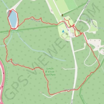
Simon B. Elliot State Park Trails
- Distance: 4.3 Km
- Elevation gain: 49 m
- Maximum elevation: 665 m
- Elevation loss: 45 m
- Minimum elevation: 629 m
- Moving time: 55 m 59 s
- Moving speed: 4.6 Km/h
- Maximum speed: 15.6 Km/h
- Total time: 1 h 12 m
- Global speed: 3.6 Km/h
Interactive trail map
Trail profile
- Distance: 4.3 Km
- Elevation gain: 49 m
- Maximum elevation: 665 m
- Elevation loss: 45 m
- Minimum elevation: 629 m
- Moving time: 55 m 59 s
- Moving speed: 4.6 Km/h
- Maximum speed: 15.6 Km/h
- Total time: 1 h 12 m
- Global speed: 3.6 Km/h
About this trail
Name: Simon B. Elliot State Park Trails trail, distance, elevation, map, profile, GPS track
Coordinates: 41.10699 -78.53445 41.11514 -78.52222