Mount Bauerman and Kootenai Brown Peak
- Distance: 14.3 Km
- Elevation gain: 746 m
- Maximum elevation: 2,475 m
- Elevation loss: 1,220 m
- Minimum elevation: 1,483 m
- Moving time: 5 h 19 m
- Moving speed: 2.7 Km/h
- Maximum speed: 6.3 Km/h
- Total time: 8 h 11 m
- Global speed: 1.7 Km/h
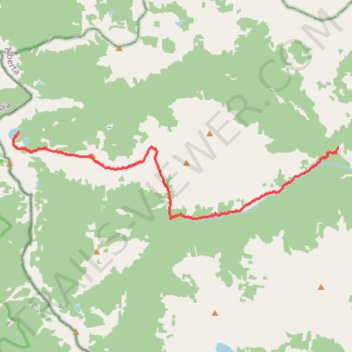
Interactive trail map
Trail profile
- Distance: 14.3 Km
- Elevation gain: 746 m
- Maximum elevation: 2,475 m
- Elevation loss: 1,220 m
- Minimum elevation: 1,483 m
- Moving time: 5 h 19 m
- Moving speed: 2.7 Km/h
- Maximum speed: 6.3 Km/h
- Total time: 8 h 11 m
- Global speed: 1.7 Km/h
About this trail
Name: Mount Bauerman and Kootenai Brown Peak trail, distance, elevation, map, profile, GPS track
Start: Tamarack Trail, Improvement District No. 04, Alberta, Canada (49.13468 -114.15473)
End: Blakiston Falls Trail, Improvement District No. 04, Alberta, Canada (49.13056 -114.02745)
Coordinates: 49.11204 -114.15693 49.13470 -114.02745
Other hiking, mountain biking, running and outdoor activity trails
Click on a trail to view its statistics, map and profile.
Hike Lone Lake to Festubert Mountain and back
Canada > Alberta > Improvement District No. 04
Distance: 20.9 Km • Elevation gain: 1,010 m • Maximum elevation: 2,510 m