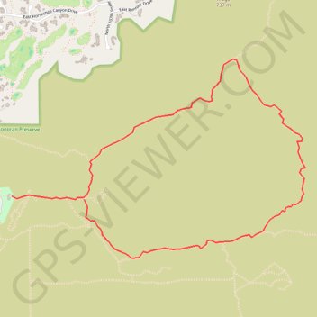
McDowell Sonoran Preserve
Interactive trail map
Trail profile
- Distance: 6.2 Km
- Elevation gain: 231 m
- Maximum elevation: 728 m
- Elevation loss: 211 m
- Minimum elevation: 526 m
About this trail
Name: McDowell Sonoran Preserve trail, distance, elevation, map, profile, GPS track
Start: Saguaro Trail, Scottsdale, Maricopa County, Arizona, 85255, United States (33.64939 -111.85822)
End: Gateway Loop Trail, Scottsdale, Maricopa County, Arizona, 85060, United States (33.64914 -111.85209)
Coordinates: 33.64501 -111.85822 33.65909 -111.83331
Other hiking, mountain biking, running and outdoor activity trails
Click on a trail to view its statistics, map and profile.