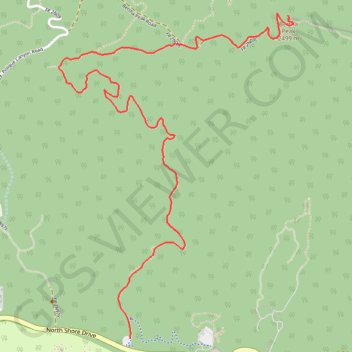
Bertha Peak
Hike from Big Bear Lake to Bertha Peak via Cougar Crest Trail, Pacific Crest National Scenic Trail (PCT) and Bertha Peak Road in the San Bernardino National Forest. #Hiking #Nature #Lake #Mountain #Forest #PCT
- Distance: 5.7 Km
- Elevation gain: 437 m
- Maximum elevation: 2,487 m
- Elevation loss: 41 m
- Minimum elevation: 2,088 m
Interactive trail map
Trail profile
- Distance: 5.7 Km
- Elevation gain: 437 m
- Maximum elevation: 2,487 m
- Elevation loss: 41 m
- Minimum elevation: 2,088 m
About this trail
Name: Bertha Peak trail, distance, elevation, map, profile, GPS track
End: Bertha Peak Road, San Bernardino County, California, 92333, United States (34.28310 -116.89940)
Coordinates: 34.26393 -116.91587 34.28324 -116.89904