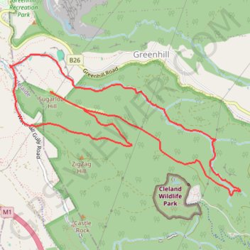
Chambers Gully Loop - Sugarloaf Hill
Interactive trail map
Trail profile
- Distance: 10.8 Km
- Elevation gain: 413 m
- Maximum elevation: 483 m
- Elevation loss: 414 m
- Minimum elevation: 180 m
About this trail
Name: Chambers Gully Loop - Sugarloaf Hill trail, distance, elevation, map, profile, GPS track
Coordinates: -34.96618 138.67187 -34.94991 138.70440
Other hiking, mountain biking, running and outdoor activity trails
Click on a trail to view its statistics, map and profile.