Copicut Miller Brook
- Distance: 16.1 Km
- Elevation gain: 145 m
- Maximum elevation: 92 m
- Elevation loss: 144 m
- Minimum elevation: 45 m
- Moving time: 1 h 44 m
- Moving speed: 9.2 Km/h
- Maximum speed: 24.3 Km/h
- Total time: 1 h 57 m
- Global speed: 8.2 Km/h
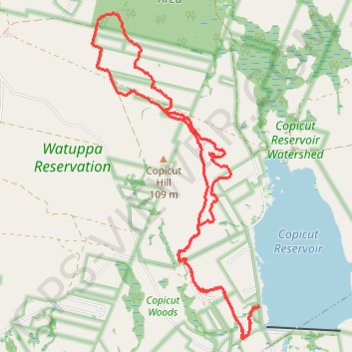
Interactive trail map
Trail profile
- Distance: 16.1 Km
- Elevation gain: 145 m
- Maximum elevation: 92 m
- Elevation loss: 144 m
- Minimum elevation: 45 m
- Moving time: 1 h 44 m
- Moving speed: 9.2 Km/h
- Maximum speed: 24.3 Km/h
- Total time: 1 h 57 m
- Global speed: 8.2 Km/h
About this trail
Name: Copicut Miller Brook trail, distance, elevation, map, profile, GPS track
End: MB10 - Copicut Road, Fall River, Bristol County, Massachusetts, United States (41.70243 -71.04364)
Coordinates: 41.69837 -71.07216 41.74022 -71.04348
Other hiking, mountain biking, running and outdoor activity trails
Click on a trail to view its statistics, map and profile.
Copicut Miller Brook
United States > Massachusetts > Bristol County > Fall River
Distance: 14.6 Km • Elevation gain: 106 m • Maximum elevation: 83 m