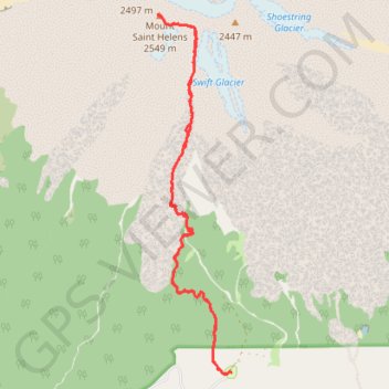
Climb up Mount Saint Helens summer trail
- Distance: 15.6 Km
- Elevation gain: 1,519 m
- Maximum elevation: 2,530 m
- Elevation loss: 1,519 m
- Minimum elevation: 1,138 m
- Moving time: 8 h 7 m
- Moving speed: 1.9 Km/h
- Maximum speed: 40.2 Km/h
- Total time: 15 h 23 m
- Global speed: 1.0 Km/h
Interactive trail map
Trail profile
- Distance: 15.6 Km
- Elevation gain: 1,519 m
- Maximum elevation: 2,530 m
- Elevation loss: 1,519 m
- Minimum elevation: 1,138 m
- Moving time: 8 h 7 m
- Moving speed: 1.9 Km/h
- Maximum speed: 40.2 Km/h
- Total time: 15 h 23 m
- Global speed: 1.0 Km/h
About this trail
Name: Climb up Mount Saint Helens summer trail trail, distance, elevation, map, profile, GPS track
Coordinates: 46.14615 -122.19584 46.19147 -122.18239