Glenfarg North Tunnel
- Distance: 2.0 Km
- Elevation gain: 24 m
- Maximum elevation: 102 m
- Elevation loss: 54 m
- Minimum elevation: 60 m
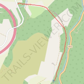
Interactive trail map
Trail profile
- Distance: 2.0 Km
- Elevation gain: 24 m
- Maximum elevation: 102 m
- Elevation loss: 54 m
- Minimum elevation: 60 m
About this trail
Name: Glenfarg North Tunnel trail, distance, elevation, map, profile, GPS track
End: Aberargie, Perth and Kinross, Scotland, PH2 9HH, United Kingdom (56.31940 -3.37099)
Coordinates: 56.30717 -3.37099 56.31962 -3.35701
Other hiking, mountain biking, running and outdoor activity trails
Click on a trail to view its statistics, map and profile.
Glenfarg Railway Tunnels Circular
United Kingdom > Scotland > Perth and Kinross > Glenfarg > Arngask
Distance: 13.1 Km • Elevation gain: 204 m • Maximum elevation: 198 m