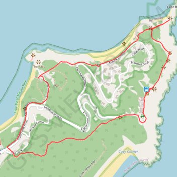
Byron Bay Lighthouse Loop
Interactive trail map
Trail profile
- Distance: 3.8 Km
- Elevation gain: 160 m
- Maximum elevation: 77 m
- Elevation loss: 160 m
- Minimum elevation: 1 m
About this trail
Name: Byron Bay Lighthouse Loop trail, distance, elevation, map, profile, GPS track
Coordinates: -28.64263 153.62654 -28.63427 153.63789
Other hiking, mountain biking, running and outdoor activity trails
Click on a trail to view its statistics, map and profile.