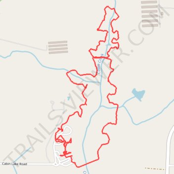
Cabin Lake Loop Trail
- Distance: 7.1 Km
- Elevation gain: 63 m
- Maximum elevation: 34 m
- Elevation loss: 64 m
- Minimum elevation: 22 m
- Moving time: 1 h 33 m
- Moving speed: 4.6 Km/h
- Maximum speed: 10.7 Km/h
- Total time: 2 h 18 m
- Global speed: 3.1 Km/h
Interactive trail map
Trail profile
- Distance: 7.1 Km
- Elevation gain: 63 m
- Maximum elevation: 34 m
- Elevation loss: 64 m
- Minimum elevation: 22 m
- Moving time: 1 h 33 m
- Moving speed: 4.6 Km/h
- Maximum speed: 10.7 Km/h
- Total time: 2 h 18 m
- Global speed: 3.1 Km/h
About this trail
Name: Cabin Lake Loop Trail trail, distance, elevation, map, profile, GPS track
Start: 261, Cabin Lake Road, Duplin County, North Carolina, 28572, United States (34.98293 -77.79929)
End: 261, Cabin Lake Road, Duplin County, North Carolina, 28572, United States (34.98293 -77.79926)
Coordinates: 34.98044 -77.79929 34.99460 -77.79250