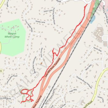
Pinecliff Audubon Sanctuary
- Distance: 5.4 Km
- Elevation gain: 146 m
- Maximum elevation: 183 m
- Elevation loss: 145 m
- Minimum elevation: 110 m
- Moving time: 1 h 6 m
- Moving speed: 4.8 Km/h
- Maximum speed: 8.4 Km/h
- Total time: 1 h 17 m
- Global speed: 4.1 Km/h
Interactive trail map
Trail profile
- Distance: 5.4 Km
- Elevation gain: 146 m
- Maximum elevation: 183 m
- Elevation loss: 145 m
- Minimum elevation: 110 m
- Moving time: 1 h 6 m
- Moving speed: 4.8 Km/h
- Maximum speed: 8.4 Km/h
- Total time: 1 h 17 m
- Global speed: 4.1 Km/h
About this trail
Name: Pinecliff Audubon Sanctuary trail, distance, elevation, map, profile, GPS track
Coordinates: 41.16530 -73.77299 41.17975 -73.76014
Other hiking, mountain biking, running and outdoor activity trails
Click on a trail to view its statistics, map and profile.