Mount Kilcoy Loop
Bellthorpe National Park. Conondale National Park. #MTB #Loop #Bellthorpe #Conondale
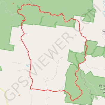
- Distance: 58.4 Km
- Elevation gain: 1,487 m
- Maximum elevation: 717 m
- Elevation loss: 1,487 m
- Minimum elevation: 125 m
Interactive trail map
Trail profile
- Distance: 58.4 Km
- Elevation gain: 1,487 m
- Maximum elevation: 717 m
- Elevation loss: 1,487 m
- Minimum elevation: 125 m
About this trail
Name: Mount Kilcoy Loop trail, distance, elevation, map, profile, GPS track
Start: Jenkinson Road, Mount Kilcoy, Somerset Regional, Queensland, Australia (-26.87348 152.58678)
End: Jenkinson Road, Mount Kilcoy, Somerset Regional, Queensland, Australia (-26.87345 152.58672)
Coordinates: -26.89131 152.56436 -26.74626 152.68123
Other hiking, mountain biking, running and outdoor activity trails
Click on a trail to view its statistics, map and profile.
Bellthorpe - Stoney Creek
Australia > Queensland > Bellthorpe
Bellthorpe National Park. #MTB #Loop #Bellthorpe
Distance: 40.8 Km • Elevation gain: 1,285 m • Maximum elevation: 664 m