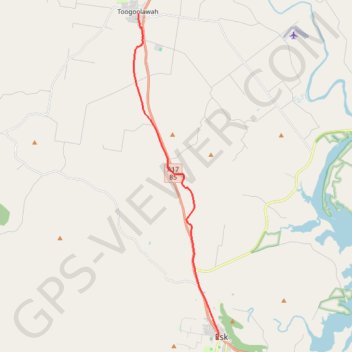
Brisbane Valley Rail Trail: Toogoolawah - Esk
Interactive trail map
Trail profile
- Distance: 19.1 Km
- Elevation gain: 128 m
- Maximum elevation: 178 m
- Elevation loss: 116 m
- Minimum elevation: 95 m
About this trail
Name: Brisbane Valley Rail Trail: Toogoolawah - Esk trail, distance, elevation, map, profile, GPS track
End: Brisbane Valley Rail Trail, Esk, Somerset Regional, Queensland, Australia (-27.24084 152.41996)
Coordinates: -27.24084 152.37571 -27.08790 152.42051
Other hiking, mountain biking, running and outdoor activity trails
Click on a trail to view its statistics, map and profile.