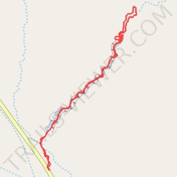
Death Canyon hiking / canyoneering
- Distance: 4.1 Km
- Elevation gain: 93 m
- Maximum elevation: 1,506 m
- Elevation loss: 93 m
- Minimum elevation: 1,444 m
- Moving time: 1 h 5 m
- Moving speed: 3.8 Km/h
- Maximum speed: 6.7 Km/h
- Total time: 1 h 55 m
- Global speed: 2.1 Km/h
Interactive trail map
Trail profile
- Distance: 4.1 Km
- Elevation gain: 93 m
- Maximum elevation: 1,506 m
- Elevation loss: 93 m
- Minimum elevation: 1,444 m
- Moving time: 1 h 5 m
- Moving speed: 3.8 Km/h
- Maximum speed: 6.7 Km/h
- Total time: 1 h 55 m
- Global speed: 2.1 Km/h
About this trail
Name: Death Canyon hiking / canyoneering trail, distance, elevation, map, profile, GPS track
Start: SR 95, Garfield County, Utah, United States (38.04639 -110.58164)
End: SR 95, Garfield County, Utah, United States (38.04639 -110.58173)
Coordinates: 38.04639 -110.58252 38.05830 -110.57365