Marina am Stau
- Distance: 37.9 Km
- Elevation gain: 13 m
- Maximum elevation: 1 m
- Elevation loss: 14 m
- Minimum elevation: -3 m
- Moving time: 6 h 36 m
- Moving speed: 5.7 Km/h
- Maximum speed: 20.7 Km/h
- Total time: 6 h 41 m
- Global speed: 5.7 Km/h
Interactive trail map
Trail profile
- Distance: 37.9 Km
- Elevation gain: 13 m
- Maximum elevation: 1 m
- Elevation loss: 14 m
- Minimum elevation: -3 m
- Moving time: 6 h 36 m
- Moving speed: 5.7 Km/h
- Maximum speed: 20.7 Km/h
- Total time: 6 h 41 m
- Global speed: 5.7 Km/h
About this trail
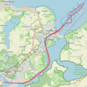
Name: Marina am Stau trail, distance, elevation, map, profile, GPS track
Coordinates: 53.89440 10.77092 53.99770 10.94681
Other hiking, mountain biking, running and outdoor activity trails
Click on a trail to view its statistics, map and profile.
TET-Germany-Section1-20210518
Germany > Schleswig-Holstein > Ostholstein > Fehmarn > Puttgarden
Distance: 479.4 Km • Elevation gain: 1,685 m • Maximum elevation: 127 m